Field Innovation and Collaboration – Development Event Summary
- Jan 9
- 1 min read
Last week, DroneWild hosted a three-day Development Event in Galloway Forest Park. We would like to take this opportunity to extend our thanks to all participants for their engagement, to Forestry and Land Scotland for hosting us and to the rangers for their valued contribution to the project.
The programme featured a varied mix of presentations, team culls, and workshops, all designed to support knowledge sharing, collaboration, and the advancement of our objectives. Such events are invaluable for obtaining feedback from those directly involved in the project and for evaluating our latest hardware and software in real-time field conditions.
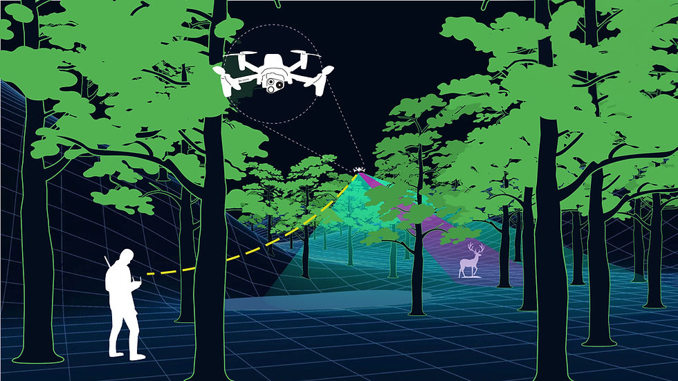
One of the most exciting developments at the event was the successful deployment of our machine learning model in real time in the field with the help of Aron Haraldsson from Vizgard. Observing the model accurately identify animals while the drone was in flight represented a significant advancement in operational capability.
The next steps will focus on continuing development of live streaming to further refine performance, as well as collating imagery to support phase three of the machine learning model, thereby strengthening its accuracy and reliability.
At this event, we also trialled the DroneWild TAK software in the field for the first time with a group of rangers. The software successfully transmitted real-time data to all participants, providing accurate information on the location of deer.
Accurate real-time location sharing is not only highly efficient and time-saving but also significantly enhances safety during operations involving multiple drones in the air.

We look forward to building on the progress and outcomes achieved throughout the three-day event and look forward to hosting the next one.

Comments